- Lenght
- 19.63 km
- Tempo
- 6 hours
- Tappa
- Max altitude
- 2736 m
- Ascent elevation gain
- 1385 m
- Descent elevation loss
- 1295 m
- Difficulty
- Hiking
- Itinerary index
- No
Informazioni
Punto di partenza
Rifugio Campo Base
Borgata Chiappera
12021 Acceglio CN
Italy
Punto di arrivo
Rifugio di Viviere
Frazione Viviere
12021 Acceglio CN
Italy
Come arrivare
Descrizione
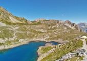
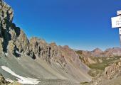
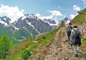
From the hamlet of Chiappera (1619 m) follow the paved road for a hundred meters to the Bastier wayside shrine, where you take the visible path on the right that, after a first flat stretch, becomes steeper and reaches firstly Pausa Grange and subsequently the Source of the Baciasset at a height of 2200 m. Here get past the fork on the right to Colle Sautron, and climb the path that reaches Passo della Cavalla, descends into the combe of the Munie lakes and finally reaches the Bonelli Bivouac and Apsoi lake. From here ignore the detour on the left and climb to Colle d'Enchiausa (2736 m) under the imposing north face of Mount Oronaye (3100 m). The descent along the valley of the same name passes the A.Valmaggia Bivouac and reaches the highest village of the valley of Unerzio, Viviere (1709 m).
Recommended period
Accessible to people with disabilities
Dettagli
Profilo altimetrico
Dati tecnici
- Code
- SFO
- Classification
- Provincial - High altitude
- Local Tourist Agency (LTA) reference
- ATL del Cuneese - valli alpine e città d'arte
- Country
- Italy
- Region
- Piemonte
- Province
- Cuneo
- Devotional relevance
- No
- Historical relevance
- No
- Ultima data di aggiornamento
- 15/12/2023
Altre info
Tappe
Tappe attività
-
0Sentiero delle FortificazioniLunghezza66.71 kmTempo4 daysDifficoltàDifficult Hiking
-
1Sentiero delle Fortificazioni: Tappa 1 Nuovo Bivacco Carmagnola - ChiapperaLunghezza12.44 kmTempo4 hours 45 minutesDifficoltàHiking
-
2Sentiero delle Fortificazioni: Tappa 2 Rifugio Campo Base - Rifugio di ViviereLunghezza19.63 kmTempo6 hoursDifficoltàHiking
-
3Sentiero delle Fortificazioni: Tappa 3 Rifugio di Viviere - Rifugio CAI della GardettaLunghezza11.74 kmTempo4 hours 45 minutesDifficoltàHiking
-
4Sentiero delle Fortificazioni: Tappa 4 Rifugio CAI della Gardetta - Località San Magno (Castelmagno)Lunghezza23.00 kmTempo7 hoursDifficoltàEscursionistico


