- Lenght
- 12.44 km
- Tempo
- 4 hours 45 minutes
- Tappa
- Max altitude
- 2937 m
- Ascent elevation gain
- 430 m
- Descent elevation loss
- 1665 m
- Difficulty
- Hiking
- Itinerary index
- No
Informazioni
Punto di partenza
Rifugio Carmagnola
12021 Acceglio CN
Italy
Punto di arrivo
Rifugio Campo Base
Borgata Chiappera
12021 Acceglio CN
Italy
Come arrivare
Descrizione
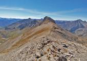
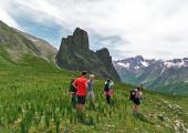
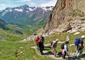
From the Carmagnola Hut (2840 m), in the Vallone di Traversiera (Traversiera Valley) (Acceglio), reach La Colletta (2830 m) where you can take the hillside path that cuts the eastern slopes of Mount Bellino and with a sharp turn to the right, you reach the peak (2937 m). Go down the opposite side reaching the col of the same name and continue along the pastures of the Autaret Valley. Avoiding the deviations on the right for Mount Maniglia and Col de Maurin, reach the grazing basin of Gr. Collet. Keep the left going up the river along the grassy cattle-track that leaves the chapel of San Francesco on the left and climbs up to Colle Greguri (2309 m), next to the rocky walls of the Rocca Castello-Provenzale group. The descent towards the village of Chiappera is easy to follow, through meadows and rocks.
Recommended period
Accessible to people with disabilities
Dettagli
Profilo altimetrico
Dati tecnici
- Code
- SFO
- Classification
- Provincial - High altitude
- Local Tourist Agency (LTA) reference
- ATL del Cuneese - valli alpine e città d'arte
- Country
- Italy
- Region
- Piemonte
- Province
- Cuneo
- Devotional relevance
- No
- Historical relevance
- No
- Ultima data di aggiornamento
- 15/12/2023
Altre info
Accommodation facilities

Campo base
- Località
ACCEGLIO (CN)
Tappe
Tappe attività
-
0Sentiero delle FortificazioniLunghezza66.71 kmTempo4 daysDifficoltàDifficult Hiking
-
1Sentiero delle Fortificazioni: Tappa 1 Nuovo Bivacco Carmagnola - ChiapperaLunghezza12.44 kmTempo4 hours 45 minutesDifficoltàHiking
-
2Sentiero delle Fortificazioni: Tappa 2 Rifugio Campo Base - Rifugio di ViviereLunghezza19.63 kmTempo6 hoursDifficoltàHiking
-
3Sentiero delle Fortificazioni: Tappa 3 Rifugio di Viviere - Rifugio CAI della GardettaLunghezza11.74 kmTempo4 hours 45 minutesDifficoltàHiking
-
4Sentiero delle Fortificazioni: Tappa 4 Rifugio CAI della Gardetta - Località San Magno (Castelmagno)Lunghezza23.00 kmTempo7 hoursDifficoltàEscursionistico


