- Lenght
- 12.00 km
- Tempo
- 2 hours 25 minutes
- Tappa
- Ascent elevation gain
- 51 m
- Difficulty
- Touristic
- Itinerary index
- No
Informazioni
Punto di partenza
Villafranca d'Asti
Piazza Marconi
14018 Villafranca d'Asti AT
Italy
Punto di arrivo
Roatto
14018 Roatto AT
Italy
Come arrivare
Descrizione
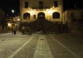
Starting from the concentric area of Villafranca, where you can visit the splendid baroque church of Castellamonte, you leave the main nucleus first crossing the state road and then, through an underpass, the motorway. The first stretch of the path follows a white road parallel to the motorway itself, then you continue until you reach the Crocetta region and then head north, entering the environment of Valtriversa. The name comes from the river Traversola, the main waterway of the valley, to which we owe the name and on whose banks, in the past, there were numerous mills, very important in the local economy. At the Traversola stream we can take the 3A variant that connects to the Via dell'acqua and then to San Paolo Solbrito. We continue along stage 3 and we cross the valley, crossing cultivated fields and small wooded areas until we reach the crossroads with the SP 10, from which we can climb up to the concentric Maretto, through a country road that leads directly to the center. Maretto, whose name derives from the Latin Meleto (a place characterized by the presence of apple trees), whose origins probably date back to Roman times, gave rise in the past to three distinct settlements Meletum de Troya (Maretto), Meletum Roatum (Roatto), Meletum de Montafia (the latter settlement later disappeared). The most significant element of Maretto is the parish church, built in the 18th century and dedicated to Saints Mary and Michael. The church of the S. Croce, built in the XVII century and already seat of the confraternity of the "battuti", is also very important. Crossing the old town centre, you continue until you reach the very close nucleus of Roatto, the final point of the third stage. From here we can take the 3A variant connecting to the Via dei Santi and the municipality of Cortandone or the 3B variant. The history of Roatto seems to have never been affected by episodes of war as many of the municipalities of Asti and these events are reflected in its castle that over time has become a stately home. The 19th century parish church of Saints Michael and Radegond, built on the site of an earlier church of ancient origin, is also of considerable importance.
Recommended period
Accessible to people with disabilities
Dettagli
Profilo altimetrico
Dati tecnici
- Code
- VBR
- Classification
- Provincial - Mid and Low Altitude
- Country
- Italy
- Region
- Piemonte
- Province
- Asti
- Devotional relevance
- No
- Historical relevance
- No
- Ultima data di aggiornamento
- 15/12/2023
Altre info
Accommodation facilities

Foresteria della pieve
- Località
VILLAFRANCA D'ASTI (AT)

Il germoglio
- Località
ROATTO (AT)

Ca' marianna
- Località
ROATTO (AT)

La corte san michele
- Località
ROATTO (AT)

La corte san michele cav
- Località
ROATTO (AT)
Tappe
Tappe attività
-
-
1Via dei Briganti: Tappa 1 Cisterna d'Asti - FerrereLunghezza14.00 kmTempo3 hours 20 minutesDifficoltàTouristic
-
1AVia dei Briganti: Tappa 1A Cisterna d'Asti Loc. Valle Oscura - Area attrezzataLunghezza1.20 kmTempo25 minutesDifficoltàTouristic
-
1BVia dei Briganti: Tappa 1B Bivio tappa 1 - Ferrere centro storicoLunghezza1.70 kmTempo25 minutesDifficoltàTouristic
-
2Via dei Briganti: Tappa 2 Ferrere - Villafranca d'AstiLunghezza14.00 kmTempo3 hours 35 minutesDifficoltàTouristic
-
3Via dei Briganti: Tappa 3 Villafranca d'Asti - RoattoLunghezza12.00 kmTempo2 hours 25 minutesDifficoltàTouristic
-
3AVia dei Briganti: Tappa 3A: San Paolo Solbrito - Cascina SabbioneLunghezza7.20 kmTempo2 hours 25 minutesDifficoltàTouristic
-
3BVia dei Briganti: Tappa 3B Roatto - Frazione PangeriLunghezza1.80 kmTempo40 minutesDifficoltàTouristic
