Activity type
Cicloescursionismo
no
- Lenght
- 6.80 km
- Tempo
- 1 hour 45 minutes
- Tappa
- Max altitude
- 426 m
- Ascent elevation gain
- 171 m
- Descent elevation loss
- 145 m
- Difficulty
- Very easy
- Itinerary index
- No
Informazioni
Punto di partenza
Address
Viale
Via Marconi, 20
14010 Viale AT
Italy
Altitude
251 m
{"type":"Point","coordinates":[8.05179,44.99887]}
Punto di arrivo
Arrival address
Piea
Piazza Italia, 7
14020 Piea AT
Italy
Arrival altitude
277 m
{"type":"Point","coordinates":[8.07187,45.02515]}
Come arrivare
Public transport access
No
Descrizione
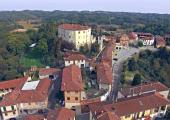
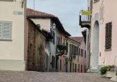
Go halfway up the hills, following the winding route, up to the village of Mongiglietto, below the town of Cortazzone.
After about 1 km you arrive at the splendid church of San Secondo of Cortazzone, a masterpiece of Romanesque Asti.
Recommended period
All Year round
All year
Accessible to people with disabilities
No
Dettagli
Profilo altimetrico
Dati tecnici
- Code
- CCS
- Classification
- Provincial
- Country
- Italy
- Region
- Piemonte
- Province
- Asti
- Devotional relevance
- No
- Historical relevance
- No
{"type":"LineString","coordinates":[[8.05178,44.99888],[8.05117,44.99906],[8.05101,44.99923],[8.05075,45.00015],[8.05052,45.00041],[8.05035,45.00058],[8.05011,45.00071],[8.04972,45.00087],[8.04972,45.001],[8.04982,45.00114],[8.04977,45.00159],[8.0496,45.00216],[8.04948,45.00245],[8.04919,45.0028],[8.04909,45.00307],[8.04915,45.00326],[8.04926,45.0035],[8.04933,45.00418],[8.04928,45.00457],[8.04903,45.00495],[8.04882,45.00519],[8.04898,45.00546],[8.04913,45.00561],[8.04922,45.00563],[8.04947,45.00524],[8.04969,45.00509],[8.05029,45.00487],[8.05065,45.00464],[8.05083,45.00439],[8.05103,45.0042],[8.05107,45.00398],[8.05142,45.00395],[8.0522,45.00361],[8.05275,45.00351],[8.05322,45.00356],[8.05371,45.00367],[8.0542,45.0037],[8.05463,45.00367],[8.05533,45.00355],[8.05613,45.00344],[8.05694,45.00346],[8.0576,45.00349],[8.05837,45.00351],[8.05874,45.00348],[8.05906,45.00332],[8.05949,45.00304],[8.05977,45.00286],[8.05988,45.00289],[8.06025,45.00334],[8.06056,45.00362],[8.06084,45.00413],[8.0611,45.00425],[8.06136,45.0043],[8.06139,45.00447],[8.06139,45.00464],[8.06225,45.00452],[8.06289,45.00445],[8.06359,45.00449],[8.06415,45.00456],[8.06373,45.00473],[8.06347,45.00485],[8.06334,45.00531],[8.06347,45.00559],[8.06346,45.00599],[8.06347,45.0063],[8.06359,45.00676],[8.06379,45.00737],[8.06392,45.00775],[8.06397,45.00833],[8.06412,45.00889],[8.06418,45.00898],[8.06429,45.00977],[8.06447,45.01041],[8.06474,45.01113],[8.06486,45.01152],[8.06497,45.01189],[8.06543,45.01261],[8.06597,45.01338],[8.06611,45.01362],[8.06636,45.01408],[8.06665,45.01465],[8.06692,45.0155],[8.06725,45.01647],[8.06755,45.01641],[8.06815,45.01668],[8.07002,45.01725],[8.07131,45.01839],[8.07238,45.01886],[8.07332,45.01939],[8.07365,45.01946],[8.07394,45.01948],[8.07449,45.01937],[8.07498,45.01922],[8.07536,45.01923],[8.07586,45.01942],[8.07678,45.01977],[8.07712,45.01976],[8.07784,45.0195],[8.07836,45.01925],[8.07824,45.02027],[8.07785,45.02172],[8.07781,45.02207],[8.07793,45.02239],[8.07844,45.0229],[8.07854,45.02318],[8.07853,45.02352],[8.07864,45.02383],[8.07874,45.02436],[8.07874,45.02452],[8.0785,45.02479],[8.07835,45.02494],[8.07823,45.02485],[8.078,45.02457],[8.07746,45.02404],[8.07697,45.02365],[8.07645,45.02341],[8.07572,45.02317],[8.07497,45.02292],[8.07403,45.0226],[8.07146,45.02206],[8.07101,45.02205],[8.07013,45.02213],[8.06929,45.02223],[8.06945,45.02231],[8.06959,45.02244],[8.06971,45.02264],[8.06983,45.02278],[8.07002,45.02282],[8.07026,45.0228],[8.0704,45.02273],[8.07056,45.02259],[8.07076,45.02247],[8.07092,45.02245],[8.07104,45.0225],[8.07107,45.02259],[8.07086,45.02306],[8.07047,45.02331],[8.07034,45.02346],[8.07028,45.02366],[8.07047,45.02387],[8.07118,45.02436],[8.0717,45.02501],[8.07188,45.02516]]}
- Ultima data di aggiornamento
- 15/12/2023
Tappe
Tappe attività
-
0CCS - Walk among the Sacred HillsLunghezza40.30 kmTempo9 hours 40 minutesDifficoltàVery easy
-
1CCS Stage 1: Abbazia di Vezzolano - Chiesa di Sant’EusebioLunghezza5.20 kmTempo1 hour 20 minutesDifficoltàVery easy
-
2CCS Stage 2: Chiesa di Sant’Eusebio - Colle Don BoscoLunghezza6.40 kmTempo1 hour 30 minutesDifficoltàVery easy
-
3CCS Stage 3: Colle Don Bosco - CapriglioLunghezza4.80 kmTempo1 hour 5 minutesDifficoltàVery easy
-
4CCS Stage 4: Capriglio - VialeLunghezza8.50 kmTempo2 hours 10 minutesDifficoltàVery easy
-
5CCS Stage 5: Viale - PieaLunghezza6.80 kmTempo1 hour 45 minutesDifficoltàVery easy
-
6Cammino delle Colline Sacre: Stage 6 Piea - Montiglio MonferratoLunghezza8.60 kmTempo1 hour 50 minutesDifficoltàVery easy


