- Tempo
- 9 hours 15 minutes
- Tappa
- Dislivello salita
- 300 m
- Difficoltà
- Moderate difficulty
- Indice itinerario
- No
Informazioni
Punto di partenza
Cheggio Antrona Schieranco
Cheggio Antrona Schieranco VB
Italy
Punto di arrivo
Italy
Come arrivare
Descrizione
ACCESS
Highway A4 (Torino-Milano), take direction to Gravellona Toce A26, Villadossola exit, cross Villadossola, follow to Montescheno, Seppiana, Fraction Rivera (Viganella), Prabernardo, Antropiana (Antrona Schieranco), Alpe Cheggio.
ITINERARY
From Cheggio follow the C25 trail to the junction of the Alpe Campolamana (ignore the track to the left that leads to the Alpe) follow the path that leads to Rifugio Andolla. Climb with hairpin bends up to a water supply, after a few meters you start on the big plateau of the mountain pastures of Andolla and arrive at Rifugio Andolla.
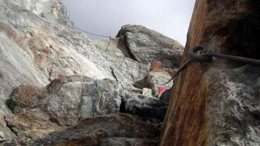
From Rifugio Andolla follow the signs for "ferrata del lago" reaching the bivouac Varese and the start of the ferrata. Go past the ferratausing the proper equipment, reaching the Col Bottarello or Sonningpass.
DESCENT
Going down from where you climbed along the ferrata in the opposite direction, to Rifugio Andolla and subsequently to the Lago dell'Alpe dam you get to Cheggio.
At the exit of the ferrata you can continue down the path toward the Swiss border along a small glacier, on the moraines with blue trail to reach the refuge of Almageller Hutte h1.25. From the Almageller Hutte lodge follow the signs to the Passo di Zwischbergen h 1.00. From the pass descend on moraines with trail marker and cairns along the valley to Alpe Cheller h 2.30, cross the stream and walk along the right bank orographic uphill to the Passo Andolla h 2.00. From the Passo descend to Rifugio Andolla h 12:35; from the lodge in 1.30 hrs you return to Cheggio.
Note: If you have available the whole day, you should stop at the Refuge Almageller Hutte and start again the next day through the way of the "5 passi" (SFT - Passo Andolla, Passo Busin , Passo della Preia h 3.00 (C26 - Passo della Preia, Preia Furà, Bocc.dei Pianei, Cheggio – h 2.10
Note: To split the path is advisable to stay overnight at the Lodge Andolla (secure) or the bivouac Varese (unattended)
Accessible to people with disabilities
Dettagli
Dati tecnici
- Esposizione
- Est
- ATL di riferimento
- ATL Distretto dei Laghi
- Nazione
- Italy
- Regione
- Piemonte
- Provincia
- Verbania
- Dislivello di avvicinamento
- 1250 m
- Altro
Provincia Verbano Cusio Ossola
Alpi Pennine
Valle Antrona
- Interesse devozionale
- No
- Interesse storico
- No
- Ultima data di aggiornamento
- 15/12/2023