- Lenght
- 1.00 km
- Tempo
- 3 hours 30 minutes
- Tappa
- Dislivello salita
- 200 m
- Difficoltà
- Low difficulty
- Indice itinerario
- No
Informazioni
Punto di partenza
Colle della Mulattiera Beaulard
Claviere TO
Italy
Punto di arrivo
Italy
Come arrivare
Descrizione
ACCESS
From Turin motorway A32 oulx exit ovest (West) take direction Beaulard Bardonecchia.From Beaulard with the road up to the village of Puys and continue along the dirt road to the Colletto del Colomion , about 2,000 meters, where it is recommended to leave the car because the road just beyond is interrupted, and the parking is difficult, parking.
ITINERARY
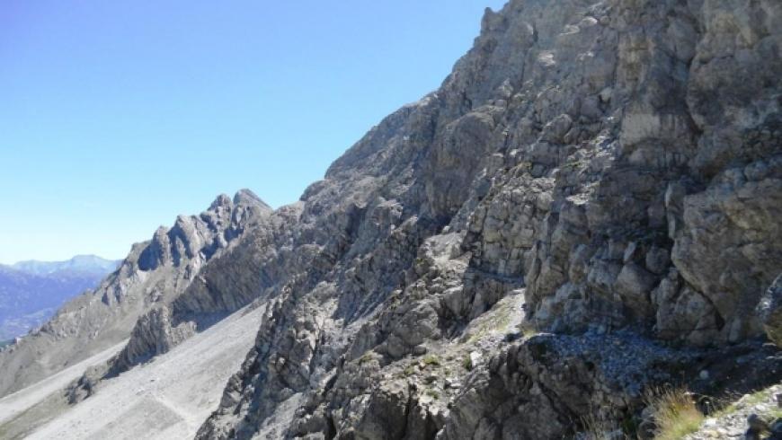
Follow on foot the route of the road to the Passo della Mulattiera.From Passo della Mulattiera climb the steep path (signpost and blue signals) over the barracks that soon takes you to the top of "Ferrata". Once at the Passo della Sanità you can climb to the summit of Punta Charrà (2,844 m.) Following the East ridge, first with the path trail on the grassy ridge then, on the rocky ridge skirting a series of spikes on the south side, easy but requires some caution and mountaineering experience.
DESCENT
Retracing the same route.
Note: high mountain Route to be undertaken only with good and hiking knowledge, only in summer.
Accessible to people with disabilities
Dettagli
Dati tecnici
- Esposizione
- Nord-Est
- Nazione
- Italy
- Regione
- Piemonte
- Provincia
- Torino
- Dislivello di avvicinamento
- 400 m
- Altro
Città Metropolitana Torino
Alpi Cozie
Alta Valle Susa
- Interesse devozionale
- No
- Interesse storico
- No
- Ultima data di aggiornamento
- 15/12/2023