Galleria foto
- Lenght
- 21.00 km
- Tempo
- 6 hours 20 minutes
- Tappa
Elenco risultati
- Max altitude
- 2556 m
- Ascent elevation gain
- 1026 m
- Descent elevation loss
- 1402 m
- Difficulty
- Difficult Hiking
- Itinerary index
- No
Informazioni
Punto di partenza
Plampinet
05100 Névache
France
Punto di arrivo
Oulx
10056 Oulx TO
Italy
Come arrivare
In auto: ss24 o A32 uscita Oulx Est, per l'accesso a Plampinet seguire per Cesana - Claviere - Monginevro
Descrizione
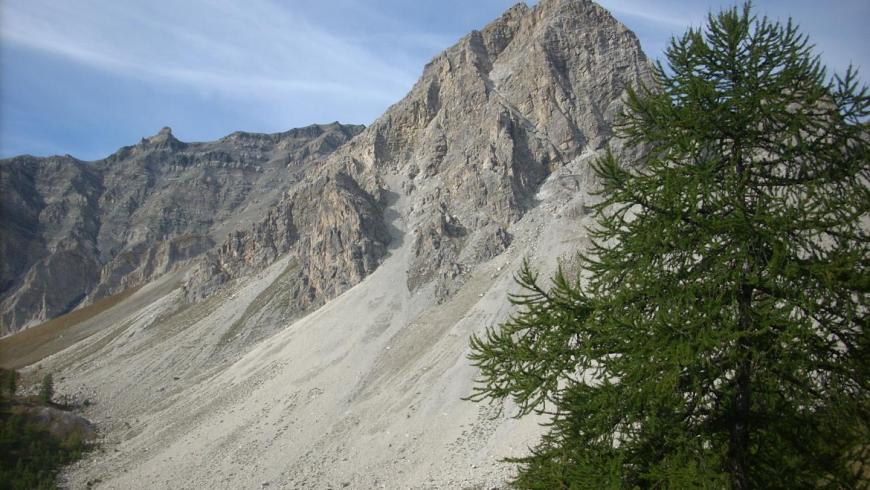
From the town of Plampinet the stage continues for a stretch in France heading up towards Saint Roch (G.R.5 trail) and touches the Chalet des Acles. Continue along the Des Acles stream to reach the junction with the 4A variant (altitude 2290) for Passo dell'Orso. Ascend, keeping to your right, to reach Passo di Desertes (altitude 2553), on the Italian-French border, just beyond which there is the Ricovero Passo di Desertes mountain shelter. Continuing on path 601B, towards Pourachet you touch the summit of Punta Madonna del Cotolivier and then begin the long descent towards the town of Oulx, passing through the villages of Vazon and Pierremenaud, thus rejoining the route of stage 1 of the itinerary.
Recommended period
Accessible to people with disabilities
Support points
Plampinet, Oulx
Dettagli
Profilo altimetrico
Dati tecnici
- Code
- TCH
- Classification
- Provincial - Mid and Low Altitude
- Cell phone coverage
Buona, prevedere roaming internazionale
- Country
- Italy
- France
- Region
- Piemonte
- Auvergne-Rhône-Alpes
- Province
- Torino
- Devotional relevance
- No
- Historical relevance
- No
- Ultima data di aggiornamento
- 15/12/2023
Altre info
Accommodation facilities

Structure qualification
Alba serena
Località
OULX (TO)
Structure qualification
Trilly
Località
OULX (TO)
Structure qualification
Edelweiss
Località
OULX (TO)
Structure qualification
Per te
Località
OULX (TO)
Tappe
Tappe attività
-
0TCH - Tour dello ChabertonLunghezza85.20 kmTempo20 hours 15 minutesDifficoltàDifficult Hiking
-
1Chaberton Tour: Stage 1 Oulx - Cesana TorineseLunghezza15.80 kmTempo4 hours 15 minutesDifficoltàHiking
-
2TCH Tappa 2: Cesana Torinese - ClaviereLunghezza30.00 kmTempo6 hoursDifficoltàDifficult Hiking
-
2AChaberton Tour: Stage 2A Rollieres - FenilsLunghezza10.30 kmTempo2 hours 30 minutesDifficoltàHiking
-
3Chaberton Tour: Stage 3 Claviere - PlampinetLunghezza18.40 kmTempo3 hours 40 minutesDifficoltàHiking
-
4Chaberton Tour: Stage 4 Plampinet - OulxLunghezza21.00 kmTempo6 hours 20 minutesDifficoltàDifficult Hiking
-
4AChaberton Tour: Stage 4A: Junction with Stage 4 at Passo dell'Orso - Rifugio ReyLunghezza4.60 kmTempo2 hours 15 minutesDifficoltàDifficult Hiking