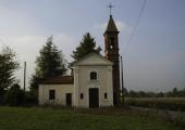
Via dell'Acqua: Tappa 2 Valfenera - Villanova d'Asti

Galleria foto
Activity type
Escursionismo
no
Lenght
25.00 km
Tempo
6 hours
Tappa
Descent elevation loss
17 m
Difficulty
Touristic
Itinerary index
No
    Informazioni

    Punto di partenza

    Address

    Valfenera
    14017 Valfenera AT
    Italy

    Altitude
    277 m
    {"type":"Point","coordinates":[7.96438,44.89924]}

    Punto di arrivo

    Arrival address

    Villanova d'Asti
    14019 Villanova d'Asti AT
    Italy

    Arrival altitude
    260 m
    {"type":"Point","coordinates":[7.93767,44.94228]}

    Come arrivare

    Public transport access
    No

    Descrizione

    From the concentric of Valfenera we head south, through the valley, through areas characterized by a strong presence of woods and arriving at the hamlet of San Sebastiano, where we can visit the small eighteenth-century church. We continue along the ridge, appreciating the various panoramic points until we reach Valmaggiore, a typical settlement on the hill ridges, and continue to Frazione Villata. During the Second World War, the GL Brigade "Domenico Tamietti" settled in this hamlet, one of the first partisan groups, led by commander Giovanni Scagliola, known as "Piero". From the hamlet we continue westwards, through wooded areas and agricultural areas, to arrive at Cellarengo, near the Ferrere road. The first historical information about Cellarengo dates back to the year 862. Initially it belonged to the territories of the Abbey of Nonantola and then, in 1200, passed among the possessions of the Monastery of Sant'Anastasio di Asti. From 1214 the village became a municipality and underwent several passages between some important families of Asti. Of particular importance, historically, is the presence of a castle, richly decorated and equipped with a park and a court chapel. It suffered various vicissitudes, passing from various owners until the last of these, the brothers Jona di Canale, sold it to the peasants who destroyed it to sell the bricks making them lose their traces. Important artistic traces remain in the church of San Giovanni Battista and in the Chapel of the Madonna Assunta. Let's continue northwards for about 10 km, crossing a plain with a strong agricultural vocation thanks to the presence of numerous watercourses and little lakes, perfectly visible along the way. We cross the village of Isolabella and arrive at the concentric Villanova d'Asti, the end of the second stage. Villanova was originally a simple village called Corvaglia, belonging to the house of Saxony. In 1001 Otto III donated this village to the monastery of S. Felice of Pavia. Around it farmers began to settle in the service of the monastery and this settlement took the name of Villanova della Piana. Following some revolts of the peasants and the growing indebtedness of the monastery to quell them, the territory of Corvaglia and Villanova della Piana was sold to the municipality of Asti in 1210. Since then the village has been called Villanova d'Asti. There are numerous testimonies in the territory, among which we remember the church of San Martino, the Sanctuary of the Beata Vergine, the civic tower and the castle.

    Accessible to people with disabilities

    No

    Profilo altimetrico

    Dati tecnici

    Code
    VDA
    Classification
    Provincial - Mid and Low Altitude
    Country
    Italy
    Region
    Piemonte
    Province
    Asti
    Devotional relevance
    No
    Historical relevance
    No
    {"type":"LineString","coordinates":[[7.96437,44.89923],[7.96436,44.89923],[7.96339,44.89783],[7.96307,44.89773],[7.96312,44.8972],[7.96307,44.89648],[7.96349,44.89598],[7.964,44.89566],[7.96431,44.89511],[7.96453,44.89474],[7.96502,44.89449],[7.96573,44.89424],[7.96592,44.89401],[7.96686,44.893],[7.96727,44.89211],[7.9676,44.89078],[7.96767,44.89022],[7.96742,44.88954],[7.96759,44.88937],[7.96792,44.88935],[7.9683,44.88942],[7.96851,44.88923],[7.97018,44.88919],[7.97086,44.88837],[7.96985,44.88814],[7.96918,44.88784],[7.9685,44.88714],[7.96817,44.88655],[7.96785,44.88605],[7.96757,44.88591],[7.96711,44.88586],[7.96653,44.88556],[7.96595,44.88549],[7.96551,44.88511],[7.96538,44.88471],[7.96561,44.88434],[7.96541,44.88306],[7.96563,44.88179],[7.96572,44.88073],[7.96619,44.87954],[7.96666,44.8789],[7.96688,44.87794],[7.96707,44.87685],[7.96802,44.87565],[7.96909,44.87477],[7.96946,44.87435],[7.97018,44.87379],[7.97061,44.87372],[7.97063,44.87217],[7.97058,44.87134],[7.97025,44.87088],[7.96997,44.8689],[7.96851,44.86861],[7.96765,44.86857],[7.96642,44.86879],[7.96536,44.86852],[7.9639,44.86837],[7.963,44.8695],[7.96274,44.86988],[7.96109,44.87002],[7.95982,44.87001],[7.95907,44.87018],[7.95785,44.86994],[7.9574,44.87001],[7.9572,44.87024],[7.95611,44.8702],[7.95521,44.86999],[7.95402,44.86954],[7.95411,44.86922],[7.95378,44.86879],[7.95358,44.86875],[7.95264,44.86856],[7.95115,44.86852],[7.95033,44.86826],[7.94959,44.86825],[7.94872,44.86869],[7.94626,44.86853],[7.94467,44.86827],[7.94452,44.86825],[7.94428,44.8689],[7.94372,44.86939],[7.94347,44.8695],[7.94287,44.86966],[7.94155,44.86982],[7.94099,44.87023],[7.93829,44.87161],[7.93677,44.87248],[7.93566,44.87343],[7.93527,44.87396],[7.93491,44.87494],[7.93438,44.87567],[7.93392,44.87603],[7.93329,44.8767],[7.93293,44.87726],[7.93241,44.87762],[7.93094,44.87829],[7.93035,44.87885],[7.92874,44.88011],[7.92857,44.88036],[7.92806,44.88124],[7.92716,44.88326],[7.92597,44.88655],[7.92505,44.8883],[7.92495,44.88913],[7.92519,44.89136],[7.92426,44.89167],[7.92286,44.8921],[7.92174,44.89223],[7.92109,44.8925],[7.92062,44.89291],[7.91966,44.89481],[7.91879,44.89639],[7.91822,44.89715],[7.9177,44.89748],[7.91685,44.89816],[7.91537,44.89915],[7.91458,44.9001],[7.91384,44.90066],[7.91321,44.90146],[7.91218,44.90218],[7.91125,44.90294],[7.91085,44.90351],[7.90977,44.9062],[7.90995,44.9067],[7.90975,44.90737],[7.90777,44.9101],[7.90866,44.91151],[7.9105,44.91404],[7.91037,44.91422],[7.91011,44.91443],[7.91,44.91466],[7.9099,44.91692],[7.90952,44.91816],[7.90793,44.92077],[7.90729,44.92139],[7.90577,44.92374],[7.90468,44.92572],[7.90409,44.92622],[7.90407,44.92712],[7.90433,44.92712],[7.90489,44.92697],[7.90544,44.92684],[7.90671,44.92655],[7.90745,44.92634],[7.90813,44.92634],[7.90861,44.92647],[7.9089,44.92653],[7.90931,44.92661],[7.90991,44.92668],[7.91051,44.92675],[7.91081,44.92684],[7.91091,44.927],[7.91094,44.92716],[7.91101,44.92738],[7.91114,44.92759],[7.91131,44.92779],[7.91145,44.92793],[7.91165,44.92809],[7.91211,44.92833],[7.91319,44.9288],[7.91366,44.92901],[7.91428,44.92933],[7.91458,44.92949],[7.91482,44.92972],[7.91485,44.92977],[7.91515,44.93023],[7.91519,44.93028],[7.91525,44.93034],[7.91569,44.9306],[7.91594,44.93079],[7.91634,44.93113],[7.91649,44.93126],[7.91676,44.93154],[7.91682,44.93171],[7.91689,44.9321],[7.91695,44.93225],[7.91736,44.93249],[7.91773,44.93255],[7.91808,44.93264],[7.92038,44.93426],[7.92074,44.93509],[7.92088,44.93536],[7.9212,44.93602],[7.92155,44.93678],[7.922,44.93754],[7.92237,44.93807],[7.92261,44.9384],[7.92283,44.93855],[7.92304,44.93865],[7.92339,44.93893],[7.92355,44.93915],[7.92385,44.93958],[7.92407,44.93986],[7.92434,44.94017],[7.92459,44.94043],[7.92483,44.94067],[7.92515,44.94094],[7.92568,44.94133],[7.92586,44.94153],[7.92602,44.94174],[7.92614,44.94203],[7.92699,44.94219],[7.92779,44.94237],[7.92852,44.94249],[7.92923,44.94251],[7.92965,44.94249],[7.93028,44.94248],[7.9323,44.94242],[7.9326,44.94245],[7.9335,44.94239],[7.93607,44.94234],[7.93767,44.94228],[7.93767,44.94228]]}
    Ultima data di aggiornamento
    15/12/2023

    Accommodation facilities

    Structure qualification
    Agriturismo

    Le verne

    Località

    VALFENERA (AT)

    Structure qualification
    Bed & breakfast

    Il mio gelso

    Località

    VILLANOVA D'ASTI (AT)

    Tappe attività