- Tempo
- 2 hours 30 minutes
- Tappa
- Dislivello salita
- 100 m
- Difficoltà
- Low difficulty
- Indice itinerario
- No
Informazioni
Punto di partenza
Viola San Grèe Cappella di Santa Caterina
Viola San Grèe Cappella di Santa Caterina CN
Italy
Punto di arrivo
Italy
Come arrivare
Descrizione
ACCESS
Turin-Savona motorway, exit Ceva, then to Val Mongia, Poggi, Plans, Lisio, then towards Viola Saint Gree (Castello Rocca dei Corvi) to the chapel of Santa Caterina parking.
ITINERARY
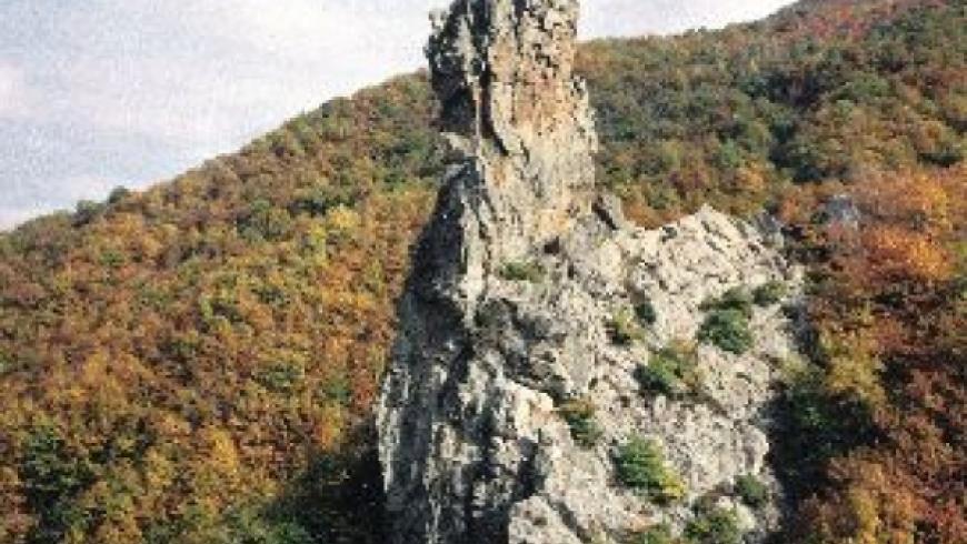
From the car park take the road to the left of the church, and following the various indications it comes down to the creek in the woods, you arrive at a gallery in front of the Rocca.
There are two ways
1- path to the left that takes only 15 minutes to the start down the river, for the full path (recommended, both the Tibetan bridge is done upon return).
2 - on the right path in 5 minutes leads to the rope bridge.
Starting from the base of the river, it starts with a short traverse, which leads to a first cascade, where it goes to twenty meters. A bridge leads to the start of a new ridge. so we come to a final highlight with slightly overhanging sections and you are on a ledge that connects to the rope bridge (which will cover the return, or it can be used as an escape route). There begins the second part of the railway, continue left with an exposed beam, follow a vertical line. You enter in a fireplace with very exposed output. Cross to the left, overcome a series of walls and ledges very exposed, you reach the top flight path. in a reduced space summit (2/3 people) should remain secure.
DESCENT
Pay attention in the first part, some delicate and exposed points, then at the end of the stretch equipped simple route, get off into the woods keeping to the right you reach the Tibetan bridge. Past the bridge climb on the path and soon you come to the gallery of departure and for the path to the parking lot.
Accessible to people with disabilities
Dettagli
Dati tecnici
- ATL di riferimento
- ATL di Cuneo
- Nazione
- Italy
- Regione
- Piemonte
- Provincia
- Cuneo
- Dislivello di avvicinamento
- 150 m
- Altro
Provincia di Cuneo
Alpi Liguri
Valle Mongia
- Interesse devozionale
- No
- Interesse storico
- No
- Ultima data di aggiornamento
- 15/12/2023