- Tempo
- 2 hours 30 minutes
- Tappa
- Dislivello salita
- 200 m
- Difficoltà
- Moderate difficulty
- Indice itinerario
- No
Informazioni
Punto di partenza
Oropa
Oropa BI
Italy
Punto di arrivo
Italy
Come arrivare
Descrizione
ACCESS
From Biella cross Andorno Micca, Sagliano Micca, Campiglia Cervo the Oropa Sanctuary, continue to Rosazza tunnel, after 1 Km pass a restaurant and park in the bend where there the ruins of a chapel / temple lie, at its side starts a dirt road where you can park.
ITINERARY
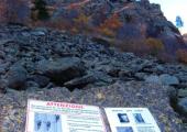
From the car park go up the path (signs) of Pissa to the Rifugio Rosazza, it gradually rises up to a stony ground at this point there is a chapel and a tower, there is a boulder with a sign indicating the direction to follow the departure of ferrata (red signs along the stony ground). the start of the ferrata signpost. It starts with a vertical path, a beam in the middle of vegetation, then overcome reddish plaques and a crosspiece, a vertical path leading to the start of a trellis, overcome it, it follows a rope bridge leading to the start of the wall opposite the trellis navigate to the right and you reach a grassy ledge in a few meters you will arrive at the base of obvious dihedral, it faces left out on a ledge, you cross a series of small walls and transoms up and you get on the slope under the cable car wires . A subsequent vertical section, a plaque will arrive at the base of a tower divided by the vertical wall by a fireplace that is traversed using the second rope bridge. It dates from the wall and it faces a crossing (very aerial) that leads to the final part, and most difficult of the railway. Climbing plates and reach a roof that is higher than the left (very exposed). You go through a few metres and reach a plateau that marks the arrival. left, right next to the tower where the cable car passes, you can see the red marks that indicate the path of return. My proposal, to make the full travel and logic, is to continue along the clear and wide grassy ridge that rises to the top of the mountain Tovo. Prior to the path trail, then following the white and red trail marker 14, you will reach the top of the mountain topped by a metal cross and the "pyramids" characteristics of Tovo. From here a magnificent view of the Po Valley, on all Biella mountains, the Monte Rosa group (F22).
DESCENT
left near the pylon of the cable car, (white-red marks) to return part of the way leading to the car park through the nozzle of the window and then the trail No. 32 to get to the Pissa road and the parking lot. After the via ferrata you can continue and climb to Monte Tovo to the grassy ridge (tracks and cairns) and then with the trail No. 14 (white-red marks) you get to the top (mt. 2.230) h1.45. (Panorama of the Po valley, the massif of Monte Rosa and Biellesi Monti). The return to the same route until the pylon of the cable car and follow the path indicated above
Accessible to people with disabilities
Dettagli
Dati tecnici
- Esposizione
- Sud
- ATL di riferimento
- ATL di Biella
- Nazione
- Italy
- Regione
- Piemonte
- Provincia
- Biella
- Dislivello di avvicinamento
- 150 m
- Altro
Provincia di Biella
Alpi Pennine
Valle Oropa
- Interesse devozionale
- No
- Interesse storico
- No
- Ultima data di aggiornamento
- 15/12/2023
