- Lenght
- 18.70 km
- Tappa
- 2 / 3
- Max altitude
- 1284 m
- Ascent elevation gain
- 600 m
- Descent elevation loss
- 85 m
- Difficulty
- Easy
- Itinerary index
- No
Informazioni
Punto di partenza
Premia
28866 Premia VB
Italy
Punto di arrivo
Formazza Frazione Ponte
28863 Formazza
Italy
Come arrivare
SS33 del Sempione, Exit Crodo Valle Antigorio - Valle Formazza, and continuing on SS 659 you reach Crodo
All the villages of the Antigorio Formazza Valley are served by the Domodossola-Cascata del Toce bus line.
Autoservizi Comazzi
Tel. 0324 240333
www.comazzibus.com
Descrizione
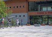
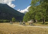
From Premia follow the state highway for 150 metres downhill (pay attention to the traffic!) and on approaching a chapel (Cappella dal Self) take the steep mule track with steps which drops down and crosses the River Toce, then climb again more steeply to the town of Cagiogno. Cycling is not possible on this stretch. Alternatively, to avoid carrying your bike on your shoulders you can continue on the state highway to Piedilago and take the tarmac road for Cagiogno. From Cagiogno follow the tarmac road almost to the bridge over the River Toce, turn left and following the tourist arrows and G00 signs you take a sheep track which skirts the artificial lake of Piedilago. From the end of the lake you return to the tarmac road which continues on the flat passing under the village of Cristo and continuing along the river. Further on the path becomes unmade again and offers beautiful views amid well kept meadows. You then come to the bridge right in front of Terme di Premia (Spa Centre of Premia). Instead of going toward the bridge follow the sings for Via del Gries and continue through the meadows alongside River Toce on a long flat stretch to until you come to Case Cini. After crossing the village continue on the sheep track which runs alongside the river until it meets a quarry road. Cross the River Toce at the ford (if there is water use the bridge at Case Cini) and you come to the state highway which take takes you to Chioso. Just after the village, in front of the beginning of the path for Alpe Vova, turn right and take a quarry road which crosses the River Toce again and then continues to a quarry (take care as this is a private road with moving vehicles!). The path continues until it rejoins the state highway at the road bridge. If you want to avoid this section on private roads, continue from Chioso along the state highway, passing Foppiano and arriving at the road bridge where the quarry road ends. From here continue following the state highway but instead of entering the tunnel you turn right and follow the old hairpin bends of the Casse which are no longer travelled by cars. You then come to Fondovalle. Here you cross the bridge over the River Toce and take the farm road, a long flat road which climbs up the valley on the left side (always follow the signs for Via del Gries) leading to Valdo and Ponte (Formazza)
Recommended period
Accessible to people with disabilities
Support points
Terme di Premia www.premiaterme.com
Interest points
Traditional stone architecture, Spa Centre of Premia, Walser culture in Formazza, Casa Forte di Ponte
Dettagli
Profilo altimetrico
Dati tecnici
- Code
- TOC
- Classification
- Provincial
- Local Tourist Agency (LTA) reference
- ATL Distretto Turistico dei Laghi
- Cell phone coverage
Ok
- Country
- Italy
- Region
- Piemonte
- Province
- Verbania
- Devotional relevance
- No
- Historical relevance
- No
- Ultima data di aggiornamento
- 31/01/2025
Tappe
Tappe attività
-
-
1MTB del Toce - Stage 1: Montecrestese - PremiaLunghezza17.70 kmTempoDifficoltàEasy
-
2MTB del Toce - Stage 2: Premia - FormazzaLunghezza18.70 kmTempoDifficoltàEasy
-
3MTB del Toce - Stage 3: Formazza - Passo San GiacomoLunghezza16.00 kmTempoDifficoltàChallenging

